BIGGEST WEEK BIRDING LOCATIONS
CLICK HERE for a printable area birding map courtesy of Lake Erie Shores & Islands!
|
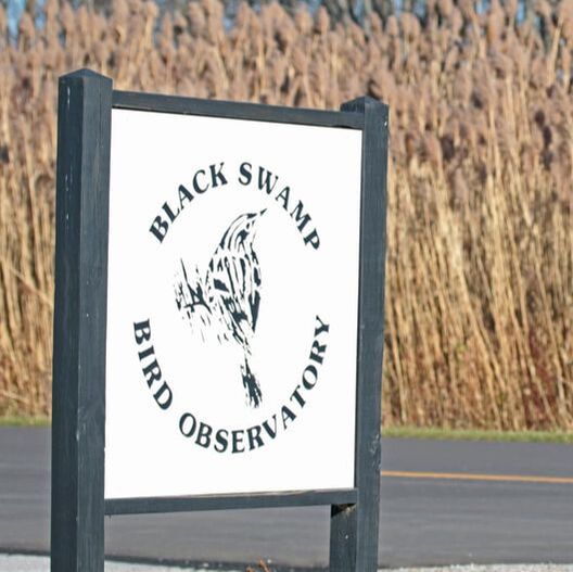
BLACK SWAMP BIRD OBSERVATORY GROUNDS
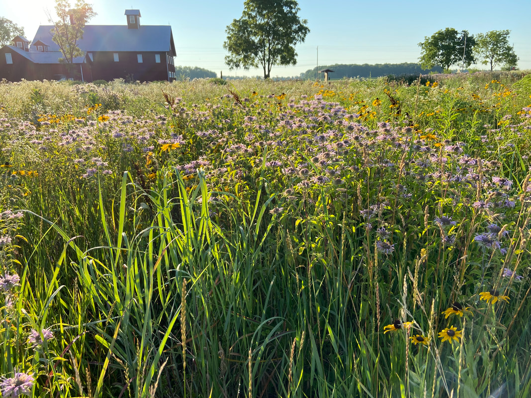
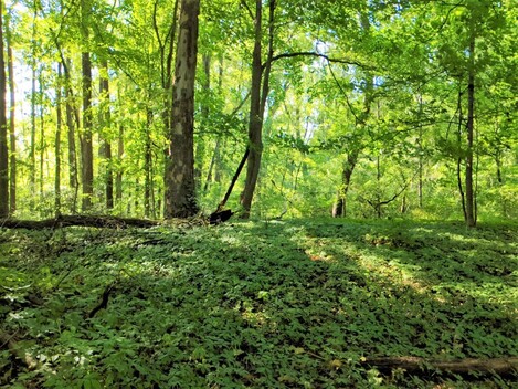
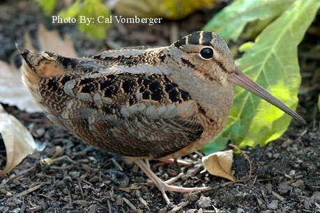
13551 West State Route 2, Oak Harbor, Ohio 43449 eBIRD LIST FOR BLACK SWAMP BIRD OBSERVATORY Just north of Ohio State Route 2, at the entrance to Magee Marsh Wildlife Area, the headquarters for Black Swamp Bird Observatory is immediately to your left. The Observatory is open on weekends year-round, open several days per week during migration season, and open every day during May. This is a good place to stop to get the latest information on sightings and hotspots, birding area maps designed by Kenn Kaufman, check out the fabulous selection of bird and nature books in the gift shop, and meet fellow birders. Behind the building is the Gallagher Memorial Trail, a walking trail leading through woodland edge, second growth woods, and meadow, all of which are often good for migrants. The Gallagher Trail also provides the area's best opportunity to experience the bizarre and dazzling display of the American Woodcock. |
|
|
CATAWBA POINT PRESERVE
4158 NW Catawba Rd., Port Clinton, OH 43452 Catawba Island Township INFO MAP OF CATAWBA POINT PRESERVE |
|
|
CEDAR CREEKS PRESERVE
4575 Walbridge Rd., Northwood, OH 43619 INFO MAP OF CEDAR CREEKS PRESERVE A mix of wet woods and grasslands, this 42-acre preserve features hiking trails allowing visitors to see a remnant Black Swamp woods, playground and picnic area. Spring wildflowers are a seasonal feature. The park also offers an open-air picnic shelter. |
|
|
CEDAR MEADOW PRESERVE
4730 E. Cemetery Rd., Port Clinton, OH 43452 Catawba Island Township INFO MAP OF CEDAR MEADOW PRESERVE The 62 acres that encompass this preserve were acquired in 2005 by Catawba Island Township, with help from the Clean Ohio Fund and the Black Swamp Conservancy. The property is a mosaic of successional fields, mature woodland, shrub zones, and wetlands. It’s location on Catawba Island, which is a peninsula that juts into Lake Erie, makes Cedar Meadow an excellent spot for migratory songbirds that are preparing to cross the lake in spring, or have just made the crossing in fall. Nearly every species of regularly occurring migrant songbird could be expected given the preserve’s diversity of habitat, and as more birders discover this site an impressive species list should be accumulated. Common warbler for this area are: Blackburnian Warbler, American Redstart, and Northern Waterthrush. Cedar Meadow is only minutes from the ferry dock that services the Bass islands and is a worthwhile stop before or after visiting the islands. |
|
|
CREEK BEND FARM
720 South Main St., Lindsey, OH 43442 INFO MAP OF CREEK BEND FARM Located along the banks of Muddy Creek, Creek Bend Farm is home to the Wilson Nature Center and the Homestead House. Visitors can experience this 310-acre property on over two miles of trails travelling through riparian, field, and woodland habitats as well as active farm land. The riparian corridor allows for excellent birding opportunities during spring and fall migration. |
|
|
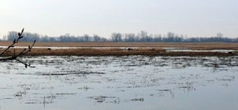
EAST HARBOR STATE PARK
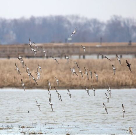
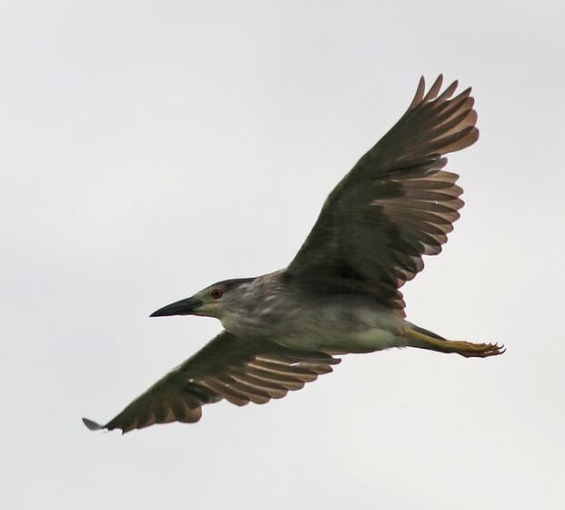
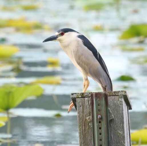
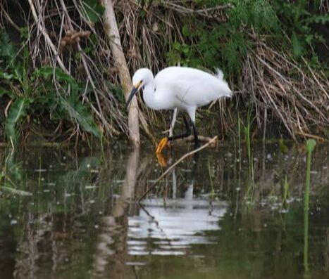
1169 N Buck Rd., Lakeside-Marblehead, OH 43440 eBIRD LIST FOR EAST HARBOR STATE PARK INFO MAP OF EAST HARBOR STATE PARK The park’s campground and beach are popular in summer but the area is outstanding for birding all year, with marshes, woods, and big concentrations of migrant songbirds in season. East Harbor lies on the fringe of Ohio's prairie marsh zone. These wetlands are remnants of the Great Black Swamp which once covered an area 120 miles long and 30 to 40 miles wide. These wetlands produce more wildlife than any other type of habitat in Ohio. Large numbers of ducks, geese, gulls, terns and other migratory waterfowl delight birdwatchers. Middle Harbor is a game sanctuary where black-crowned night herons, egrets, great blue herons and other shorebirds find refuge. Thousands of migrating songbirds rest here before winging north across the lake. |
|
|
ERIE MARSH PRESERVE
3200 Sterns Rd., Monroe, MI - Learn more HERE eBird LIST FOR ERIE MARSH PRESERVE Erie Marsh is one of the largest coastal wetlands on Lake Erie, supporting numerous animals and plants that would otherwise be hard-pressed to find suitable habitat. The most significant feature of this area is its role as a migratory and nesting area for shorebirds, waterfowl, landbirds, and in the fall, raptors. It also harbors some of Michigan’s few remaining colonies of American lotus, and swamp rose-mallow, both listed as state-threatened. Click HERE for a trail map. |
|
|
GREAT EGRET MARSH
1120 N Buck Rd., Lakeside-Marblehead, OH 43440 eBIRD LIST FOR GREAT EGRET MARSH Right across from the entrance to East Harbor State Park, Great Egret Marsh is a brand new nature preserve owned and managed by The Ohio Nature Conservancy. GEM offers a wonderful diversity of habitats from open marsh that looks great for waterbirds, woodland that should attract lots of migrants, and open fields that should be excellent for sparrows in the fall! Public Access includes a 1.2-mile loop hiking trail which includes two overlooks, and a section that is ADA-accessible. A parking area, canoe and kayak launch, and interpretive signs are also featured. From dawn to dusk daily, the public can see firsthand, the beneficial effects of coastal restoration and experience bird watching, hiking, fishing and paddling along the coast of one of the nation’s most valuable resources, Lake Erie. For more information and directions, click HERE. |
|
|
HOWARD MARSH METROPARK
611 S Howard Rd., Curtice, OH 43412 eBIRD LIST FOR HOWARD MARSH INFO MAP OF HOWARD MARSH The newest jewel among the Metroparks Toledo park system, Howard Marsh has quickly become one of the premier birding locations in Northwest Ohio. At nearly 1,000 acres, this former farmland was opened to the public in the spring of 2018 and has been nothing but spectacular! Continuing the thread of marsh lands along the shore of Lake Erie, Howard has been a welcomed habitat to Ohio rarities such as Yellow-headed Blackbird, Black-necked Stilt, Wilson’s Phalarope, King Rail, and Least Bittern, all of which have now successfully nested within the burgeoning wetland. During migration, controlled water levels can host any number of waterbirds and shorebirds, including American Golden-Plover and Black Tern. |
|
|
KELLEYS ISLAND
eBIRD LIST FOR KELLEYS ISLAND INFO MAP OF KELLEYS ISLAND This beautiful island (accessible by auto ferry from Marblehead, on Route 163 east of Port Clinton) is a popular vacation spot, but also a fine birding area, especially during migration. For Ferry information, click HERE. |
|
|
LITTLE PORTAGE RIVER WILDLIFE AREA
INFO MAP OF LITTLE PORTAGE RIVER WA Little Portage Wildlife Area is a 357 acre state wildlife area located five miles east of Port Clinton in Ottawa County. The acquisition of the Little Portage Wildlife Area began in 1956 and continued through 1995. The property was acquired using multiple state funds, including Fish Restoration federal funding. |
|
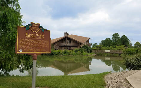
MAGEE MARSH WILDLIFE AREA
13229 W. State Route 2, Oak Harbor, OH 43449
eBIRD LIST FOR MAGEE MARSH WILDLIFE AREA
INFO BIRDING MAP OF MAGEE MARSH WILDLIFE AREA
Directions to Magee Marsh: The entrance road leads north from Ohio State Route 2 about 18 miles east of Toledo and 16 miles west of Port Clinton, or 1.5 miles east of State Route 590, 1.5 miles west of State Route 19.
Together with the Ottawa National Wildlife Refuge which is directly to the west, Magee Marsh Wildlife Area is perhaps the largest uninterrupted area of coastal wetlands habitats remaining in Ohio. There is a trail that connects the two areas. The Ottawa-Magee Partnership trail is a one mile trail that goes from the Bird Center over to the parking lot of the old Ottawa NWR office.
Half a mile north of Ohio State Route 2 is the Sportsmen’s Migratory Bird Center, the center for the Division of Wildlife’s wetland research programs. It is open to the public and has good interpretive displays. Restrooms are located here and open during the Bird Center's hours of operation. Also located here is the “hawk watch” observation tower which provides views over the marsh. A walking trail behind the center leads through a swampy woodland and around some small ponds, and often offers many warblers and other migrants.
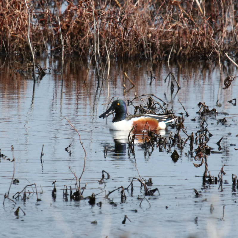
Beyond the Sportsmen’s Center, the Magee causeway runs straight north across the marsh. Three gravel pullouts on the east side of the road offer easy parking. The Magee Marsh Wildlife Area extends a short distance west and far to the east of here. The causeway offers opportunities to see many wetland birds. Swans, geese, ducks, herons, egrets, rails, Marsh Wrens, Swamp Sparrows, and others are often easily seen along the causeway. To learn more about Magee Marsh Wildlife Area, click HERE.
13229 W. State Route 2, Oak Harbor, OH 43449
eBIRD LIST FOR MAGEE MARSH WILDLIFE AREA
INFO BIRDING MAP OF MAGEE MARSH WILDLIFE AREA
Directions to Magee Marsh: The entrance road leads north from Ohio State Route 2 about 18 miles east of Toledo and 16 miles west of Port Clinton, or 1.5 miles east of State Route 590, 1.5 miles west of State Route 19.
Together with the Ottawa National Wildlife Refuge which is directly to the west, Magee Marsh Wildlife Area is perhaps the largest uninterrupted area of coastal wetlands habitats remaining in Ohio. There is a trail that connects the two areas. The Ottawa-Magee Partnership trail is a one mile trail that goes from the Bird Center over to the parking lot of the old Ottawa NWR office.
Half a mile north of Ohio State Route 2 is the Sportsmen’s Migratory Bird Center, the center for the Division of Wildlife’s wetland research programs. It is open to the public and has good interpretive displays. Restrooms are located here and open during the Bird Center's hours of operation. Also located here is the “hawk watch” observation tower which provides views over the marsh. A walking trail behind the center leads through a swampy woodland and around some small ponds, and often offers many warblers and other migrants.
Beyond the Sportsmen’s Center, the Magee causeway runs straight north across the marsh. Three gravel pullouts on the east side of the road offer easy parking. The Magee Marsh Wildlife Area extends a short distance west and far to the east of here. The causeway offers opportunities to see many wetland birds. Swans, geese, ducks, herons, egrets, rails, Marsh Wrens, Swamp Sparrows, and others are often easily seen along the causeway. To learn more about Magee Marsh Wildlife Area, click HERE.
MAGEE MARSH BOARDWALK
eBIRD LIST FOR MAGEE MARSH BOARDWALK
INFO BIRDING MAP OF THE MAGEE MARSH WA BOARDWALK
Directions to Magee Marsh: The entrance road leads north from Ohio State Route 2 about 18 miles east of Toledo and 16 miles west of Port Clinton, or 1.5 miles east of State Route 590, 1.5 miles west of State Route 19. The boardwalk is located adjacent to the large parking lot at the end of the road, about a mile and a half north of Ohio State Route 2.
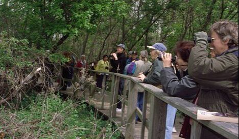
The name of this spot is subject to confusion – it is sometimes called the “Crane Creek Bird Trail,” sometimes just the “Magee Boardwalk” – but whatever it is called, it is one of the most famous birding sites in North America during the month of May. The boardwalk meanders through 7 acres of woodland situated on the beach ridge between Lake Erie and extensive marshes. Migrating birds moving north in spring often pause here just before crossing the lake, and the woodland often swarms with such migrants. The boardwalk can be absolutely fantastic for close-up views of warblers, vireos, thrushes, and other songbirds, and during the peak of migration it is not unusual to have 26 or more species of warblers at eye level during the course of a day’s birding.
Sometimes the best birding is on the north edge of the woods (south edge of the parking lots), especially early in the morning while things are quiet along the boardwalk inside the woods, and especially with south winds. The beach on the north edge of the parking lots is always worth checking for shorebirds, terns, flocks of ducks offshore, and gulls resting on the short breakwaters.
eBIRD LIST FOR MAGEE MARSH BOARDWALK
INFO BIRDING MAP OF THE MAGEE MARSH WA BOARDWALK
Directions to Magee Marsh: The entrance road leads north from Ohio State Route 2 about 18 miles east of Toledo and 16 miles west of Port Clinton, or 1.5 miles east of State Route 590, 1.5 miles west of State Route 19. The boardwalk is located adjacent to the large parking lot at the end of the road, about a mile and a half north of Ohio State Route 2.
The name of this spot is subject to confusion – it is sometimes called the “Crane Creek Bird Trail,” sometimes just the “Magee Boardwalk” – but whatever it is called, it is one of the most famous birding sites in North America during the month of May. The boardwalk meanders through 7 acres of woodland situated on the beach ridge between Lake Erie and extensive marshes. Migrating birds moving north in spring often pause here just before crossing the lake, and the woodland often swarms with such migrants. The boardwalk can be absolutely fantastic for close-up views of warblers, vireos, thrushes, and other songbirds, and during the peak of migration it is not unusual to have 26 or more species of warblers at eye level during the course of a day’s birding.
Sometimes the best birding is on the north edge of the woods (south edge of the parking lots), especially early in the morning while things are quiet along the boardwalk inside the woods, and especially with south winds. The beach on the north edge of the parking lots is always worth checking for shorebirds, terns, flocks of ducks offshore, and gulls resting on the short breakwaters.
MALLARD CLUB MARSH WILDLIFE AREA
8763 Cedar Point Rd., Oregon, OH 43605
eBIRD LIST FOR MALLARD CLUB MARSH WILDLIFE AREA
INFO BIRDING MAP OF MALLARD CLUB MARSH WILDLIFE AREA
This 402 acre marshland is a prime viewing area for migrant waterfowl (especially in March and April), and nesting marshland specialties during the breeding season. In addition, the Mallard Club Marsh has excellent potential for vagrants, such as the male Garganey seen in May of 2002.
Access to the marsh is limited to the 2 small parking areas on Cedar Point road. From either of these bases, you can walk around the dikes and view different impoundments. There is excellent cattail marsh in several impoundments, and sought-after species like American and Least bitterns and even Yellow-headed blackbirds and King rails are present in very low numbers in most years. May and June is the best time to look and listen for these birds. The Black Tern likely nests in the adjacent (and off-limits) Cedar Point marsh, and can be occasionally seen from the dikes at Mallard Club Marsh.
Hunting is a popular activity at the marsh, so the best (and safest) birding can be enjoyed in the spring and summer months. Beginning in March, large numbers of the 20 regularly-occurring Ohio ducks can be seen in the marsh itself or in adjacent Lake Erie waters just to the north. Spring hawk flights are also possible, so be sure to watch the skies in March and April. There is little woodland habitat, and as a result, very few woodland birds.
MAUMEE BAY STATE PARK
1400 State Park Rd., Oregon, OH 43616
eBIRD LIST FOR MAUMEE BAY STATE PARK
MAP OF MAUMEE BAY STATE PARK
The wetlands of the Maumee Bay area offer a vivid array of natural wonders. Wetlands contain more species of wildlife than any other habitat type, including: fox snake, northern water snake, painted turtle, chorus frog, green frog, spotted salamander, raccoon, muskrat, dragonfly, caddis fly, and water striders. Over 300 species of birds have been recorded with shorebirds such as snipe, Great Blue Heron, Common Gallinule and Ring-billed Gulls residing with waterfowl including Canada Geese, Northern Pintails, Redheads, and Ruddy Ducks. Songbirds include the Red-winged Blackbird, Yellow Warbler, Killdeer and Swamp Sparrow. Spring migration brings many others including the colorful warblers. The plant life is diverse as well. Cattails, buttonbush, bur-reed, cottonwood and black willow are just a few examples of the marsh plants at the park.
In addition to marsh and swamp wetlands, several prairies add more diversity to the landscape. Ring-necked pheasants densely populate the meadow areas of the park.
|
MEADOWBROOK MARSH
8577 E Bayshore Rd., Marblehead, OH 43440 eBIRD LIST FOR MEADOWBROOK MARSH INFO MAP OF MEADOWBROOK MARSH Located on E. Bayshore Road one-half mile west of Dempsey Access. Amenities: Picnic table, park benches, observation deck, paved biking/walking trails, grass and mulched walking trails along the prairie and in the forest. Scenic views of wetland marsh. For information about the marsh, click HERE. Directions: Follow State Route 2 to State Route 269N in Danbury Township (Exit 125A-B). Exit at 269N and continue northbound following Exit 125A until it terminates at State Route 163. Turn east and follow State Route 163 to Englebeck Road . (Englebeck is directly across from N. Shore Blvd. and Windjammer Restaurant). Turn south on Englebeck. Continue until Englebeck terminates at E. Bayshore Rd. (CR 135). Turn East. Follow E. Bayshore approximately one-half mile. Entrance to Meadowbrook is on the north side of E. Bayshore Rd. and is marked by a large “Meadowbrook Marsh” sign. |
|
METZGER MARSH WILDLIFE AREA
12600 Bono Rd., Bono, OH 43445
eBIRD LIST FOR METZGER MARSH WILDLIFE AREA
INFO BIRDING MAP OF METZGER WILDLIFE AREA
Just east of the village of Bono, the east-west highway of Ohio State Route 2 makes a major curve to run south. The well-marked turnoff to Metzger Marsh Wildlife Area is on the curve. This 558-acre marsh is outstanding for waterfowl in migration and for nesting marsh birds in summer. This is often a superb place to find bitterns, Black Tern, and Yellow-headed Blackbird. The small woodlot at the end of the road is sometimes excellent for warblers and for a wide variety of other migrant songbirds, while the lake shore is worth checking for gulls, terns, waterfowl, and a few shorebirds.
NORTHWOOD NATURE TRAILS
Curtice Rd., Northwood, OH 43619
41.616282, -83.430483
INFO BIRDING MAP OF NORTHWOOD NATURE TRAILS
Nestled off of Curtice Rd. between Bradner and S. Wynn you will find a scenic one-mile trail equipped with various exercise stations, donated by St. Charles Hospital, set up throughout. There are several benches along the trail for resting or to simply take a moment and enjoy the surroundings.
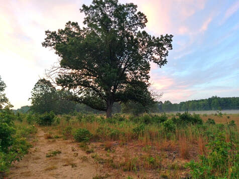
OAK OPENINGS PRESERVE METROPARK
4139 Girdham Rd., Swanton, OH 43558
eBIRD LIST FOR OAK OPENINGS PRESERVE METROPARK
MAP OF OAK OPENINGS PRESERVE
The Oak Openings region was so named because originally, the trees grew so far apart that early settlers could drive wagons through the woods in any direction. Situated on the southwest edge of the greater Toledo area, the Oak Openings still occupy almost 5,000 acres with black oak savanna, oak woodland, and wet prairies. This collection of habitats is one of the rarest in the Midwest. Birders know the Oak Openings not only for the many migrants to be seen here, but for the remarkable combinations of breeding birds that are rare elsewhere in northwest Ohio. Among the many specialty birds to be found nesting here are Lark Sparrow, Summer Tanager, Blue Grosbeak, Red-headed Woodpecker, Acadian Flycatcher, Blue-winged Warbler, Prairie Warbler, Hooded Warbler, Pine Warbler, and Yellow-breasted Chat. Part of the Toledo Metroparks, a visit to the Oak Openings Preserve is sure to spice up your trip list with some birds that you haven’t seen in the migrant traps along the lakeshore.

OTTAWA NATIONAL WILDLIFE REFUGE
14000 West State Route 2 / Oak Harbor, OH 43449
eBIRD LIST FOR OTTAWA NATIONAL WILDLIFE REFUGE
INFO BIRDING MAP OF OTTAWA NWR
With its entrance located on Ohio State Route 2, about half a mile west of the entrance to Magee Marsh Wildlife Area, Ottawa National Wildlife Refuge encompasses more than 5000 acres of managed wetlands, forests, and prairies. The refuge protects major populations of birds and offers good birding practically every day of the year.
The Visitors’ Center is a good place to start. The center itself has fine interpretive displays, knowledgeable staff and volunteers, a bookshop, and an elevated observation deck. Trails immediately behind the center lead to a boardwalk through a beautiful swampy woodland and connect to the rest of the entire trail system. The trails also can be accessed from another parking lot (see map), and it is worthwhile to walk the trails in the eastern part of the refuge to access impoundments that may be good for shorebirds, waterfowl, rails, moorhens, and other birds. The woodlots in this area, and the small trees along the edges of the impoundments, often hold large numbers of warblers and other migrants.
The auto tour route accesses many other areas of the refuge, often including spots that are very good for shorebirds, bitterns, Yellow-headed Blackbirds, and other species. For an overview of birding on the refuge, click HERE for the ONWR Overview map, for information about birding along the Auto Tour route, click HERE for the Auto Tour map and for information about birding along the trails that are open every day, click HERE for the ONWR Walking Trail map.
PEARSON METROPARK
761 Lallendorf Rd., Oregon, OH 43616
eBIRD LIST FOR PEARSON METROPARK
INFO MAP OF PEARSON METROPARK
PEARSON NORTH
Directions: Pearson Metropark is about 15 miles west of Magee Marsh andis accessed from its entrance on Lallendorf road from State Route 2.
Varied habitat affords the birder an opportunity to build a long list of birds. From the main parking area off of Lallendorf road, there is a Visitor's Center area that has good restrooms and an interesting Window on Wildlife. The Window on Wildlife can attract interesting species to either the feeders (Indigo Buntings, Purple Finch, Rose-breasted Grosbeaks are regular) or the water feature. The trees around the parking area itself often play host to numbers of warblers and other spring migrants. There are trails that go through an excellent example of remnant Black Swamp forest and you are likely to encounter a good number of birds, including some common ones that are hard to find at Magee proper: Tufted Titmouse, Hairy Woodpecker and White-breasted Nuthatch all come to mind. You are also likely to encounter Scarlet Tanagers, Ovenbird, Eastern Wood Pewees and with luck, a Cerulean Warbler.
By exiting the park at Lallendorf road to the right (north), you will come to what is known as "Pearson North" along the east side of the road. These 300 acres of open country and wetland serve different bird communities and there are gravel pull-offs that will allow you safe access along Lallendorf. Look and listen for Eastern Meadowlarks, Horned Larks, Savannah, Grasshopper and Vesper Sparrows among others. Continuing north along Lallendorf, you will cross Seaman Road, where you will turn right (east). There are additional pull offs along Seaman road, especially at the east end. The habitat gets wetter the further east you drive, and there could be a fair number of shorebirds here. Also look and listen for Virginia and Sora Rails in the cattail stands, as well as Marsh Wren. If you turn right (north) on Wynn Road, this will be the final leg of your journey to Pearson North, and this road will lead you back to State Route 2.
|
PICKEREL CREEK WILDLIFE AREA
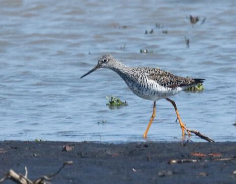
3451 County Road 256, Vickery, OH 43464 eBIRD LIST FOR PICKEREL CREEK WILDLIFE AREA INFO MAP OF PICKEREL CREEK WILDLIFE AREA On the north side of U.S.Highway 6, about 7 miles east of Fremont. A little more than half a mileeast of County Road 256 is a parking area with an observation tower giving anoverview of part of the area, and trails along the dikes provide access. Often an excellent area for shorebirds and waterfowl in migration. |
|
|
PIPE CREEK WILDLIFE AREA
F St., Sandusky, OH 44870 eBIRD LIST FOR PIPE CREEK WILDLIFE AREA INFO MAP OF PIPE CREEK WILDLIFE AREA From U.S. Highway 6 on the east side of Sandusky, turn north on Cedar Point Drive, then turn right at River Avenue (just after the McDonald’s). The small parking lot for Pipe Creek is at the end of River Avenue. Impoundments are good for shorebirds, waterfowl, and wading birds, while the woods hold fallouts of songbirds during migration. Note that traffic going to Cedar Point Amusement Park can be very heavy on warm weekends. |
|
|
RINGNECK RIDGE WILDLIFE AREA
1818 County Road 74, Gibsonburg, OH 43431 Previously a private hunt club, this area is still managed as a wildlife area to provide public hunting opportunities. The diverse habitats include open fields, woodlands, wet meadows, and limestone barrens. Several food plots are scattered throughout the property. Pheasant releases occur every fall in conjunction with the Ohio Department of Natural Resources. |
|
SECOR METROPARK
10001 Central Ave., Berkey, OH 43504
INFO MAP OF SECOR METROPARK
From tall timber to second growth forest, rolling sandy areas to wet lowlands, Secor is a place of distinct contrasts. Add meadows, prairies and northwest Ohio’s largest concentration of native dogwood and you’ve got a beautiful array of nature just outside the city.
Located on the edge of the Oak Openings Region, Secor is the northern terminus of the still-developing Oak Openings Corridor, a chain of public and private lands preserving the rare habitats that make up this fascinating region. The first leg of the Moseley Trail, which will connect these natural areas, is completed from Secor to Wiregrass Lake Metropark.
Many distinctive trees are a legacy of Secor's past as an arboretum, while Wolfinger Cemetery, the Richfield Township cemetery, is named for the area's founding family.
Park amenities include large picnic areas, playing fields, indoor meeting rooms and picnic shelters, a dedicated cross-country ski trail and a Window on Wildlife.
|
SHELDON MARSH STATE NATURE PRESERVE
2715 Cleveland Rd West, Huron, OH 44839 eBIRD LIST FOR SHELDON MARSH STATE NATURE PRESERVE INFO MAP OF SHELDON MARSH STATE NATURE PRESERVE Entrance is on the north side of U.S. Highway 6, about six miles east of Sandusky and about two miles west of Huron. Trails lead out to Lake Erie shoreline. Good for marsh birds most of year; woodlots host big concentrations of migrant songbirds in spring and fall. |
|
WILDWOOD PRESERVE METROPARK
5100 Central Ave., Toledo, OH 43615
INFO MAP OF WILDWOOD PRESERVE METROPARK
Natural beauty and manmade elegance come together as one at Wildwood Preserve, the most visited of the Metroparks. The 493-acre park is the former estate of Toledo’s Stranahan family.
Surrounded by natural habit, the stately home, now called the Manor House, played important roles in Toledo—and the park district's—history.
The main attraction at Wildwood is the system of trails that traverse varied terrain (a treat in the flatlands of northwest Ohio). The park is bisected by the Ottawa River and has sandy soil indicative of the rare Oak Openings Region.
The prairie community at Wildwood is home to many diverse and fascinating plants and animals. In the spring, it is a breeding site for ground-nesting birds such as Eastern Towhees, Field Sparrows and American Woodcock. Summer brings a spectacular display of prairie wildflowers and grasses, such as rough blazing star, big bluestem and Indian grasses, some reaching 10 feet high.